 BGS Data Catalogue
University of Bergen
Type of resources
Topics
Keywords
Contact for the resource
Provided by
Years
Formats
Representation types
Update frequencies
Resolution
-
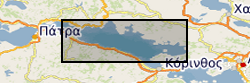
Fault and Horizon interpretations are provided for the Offshore Corinth Rift. The majority of the interpretations were based on 2D profiles from seismic reflection surveys collected by the R/V Maurice-Ewing in 2003, M.V. Vassilios in 1996 and 2003, and the R/V AEGEAO. Interpreted faults include major rift border faults as well as minor syn-rift faulting. Interpreted horizons include basement, a basin wide unconformity and five inferred transgressive surfaces based on variations in seismic character. Details of the fault and stratigraphic framework can be found in Nixon et al. (2016). Rapid spatiotemporal variations in rift structure during development of the Corinth Rift, central Greece. Tectonics, 35, 1225-1248.’ Published paper, Nixon, C. W., et al. (2016), Rapid spatiotemporal variations in rift structure during development of the Corinth Rift, central Greece, Tectonics, 35, 1225–1248, doi:10.1002/2015TC004026
-
This sampling and geophysical survey has been carried out by University of Bergen in collaboration with British Geological Survey (BGS), the survey took place in July 1996 on the North Sea Margin (North Sea Fan; Miller Slide and Faeroe-Shetland Channel) on board the RV Hakon Mosby. The purpose was to collect data as a contribution to the Europen Union’s project “European North Atlantic Margin (ENAM II): Quantification and modelling of large-scale sedimentary processes and fluxes” program. Sea floor data were collected using echo sounder. Sub-bottom profiling data were collected using airgun and deep tow boomer. Sample data were collected using gravity corer. These data are archived by University of Bergen, copy seismic records archived by BGS. Technical details of the survey are contained in University of Bergen ENAM II cruise report No. 2 (Non-BGS report reference 2006/9).
-
This marine geophysical survey took place in August 2000 on board the RV Hakon Mosby on the AFEN slide, Shetlands margin area. This was a joint contribution of the University of Bergen and the British Geological Survey to the EU COSTA (Continental Slope Stability) project. The main objective of the COSTA project is the assessment of continental slope stability along the European Continental Margin with respect to natural processes and human activity. Subsurface seismic data was collected using BGS Deep-tow boomer and Halliburton sleeve gun system. Technical details of the survey are contained in University of Bergen report 100-02/00 (BGS2000/074).
-
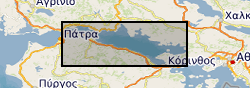
The data are derived from interpretation of seismic reflection profiles within the offshore Corinth Rift, Greece (the Gulf of Corinth) integrated with IODP scientific ocean drilling borehole data from IODP Expedition 381 (McNeill et al., 2019a, 2019b). The data include rift fault coordinate (location, geometry) information and slip rate and extension rate information for the major faults. Seismic reflection data were published in Taylor et al. (2011) and in Nixon et al. (2016). Preliminary fault interpretations and rate data, prior to IODP drilling, were published in Nixon et al. (2016). Details of datasets: The data can be viewed in GIS software (ArcGIS, QGIS) or the Excel and .dbf files can be used for viewing of rate data and import of fault coordinates into other software. The 4 folders are for different time periods with shape files for the N-Dipping and S-Dipping Faults in the offshore Corinth Rift and respective slip and extension (horizontal) rates. The shapefiles are digitised fault traces for the basement offsetting faults, picked from the Multichannel Seismic Data collected by the R/V Maurice Ewing. Fault traces are segmented and each segment has an average throw (vertical) rate (Tavg) in mm/yr. The rates for the segments are averages based on measurements at the ends of each segment. The major fault trace segments also have slip-rates (slip_rate) and extension-rates (ext_rate or extension_) in mm/yr. All rates as well as the names for major faults can be located in the attribute table of the shape files along with X- and Y-coordinates. The coordinate system is WGS84 UTM Zone 34N. The shape files can be loaded into a GIS (ArcGIS, QGIS etc.) allowing mapping and visualization of the fault traces and their activity rates. In addition, the attribute tables are .dbf files found within each folder. These have also been provided as .xlsx (Excel) files which include the fault coordinate information, and slip rates and extension rates along the major faults. References McNeill, L.C., Shillington, D.J., Carter, G.D.O., and the Expedition 381 Participants, 2019a. Corinth Active Rift Development. Proceedings of the International Ocean Discovery Program, 381: College Station, TX (International Ocean Discovery Program). McNeill, L.C., Shillington, D.J., et al., 2019b, High-resolution record reveals climate-driven environmental and sedimentary changes in an active rift, Scientific Reports, 9, 3116. Nixon, C.W., McNeill, L.C., Bull, J.M., Bell, R.E., Gawthorpe, R.L., Henstock, T.J., Christodoulou, D., Ford, M., Taylor, B., Sakellariou, S. et al., 2016. Rapid spatiotemporal variations in rift structure during development of the Corinth Rift, central Greece. Tectonics, 35, 1225–1248. Taylor, B., J. R. Weiss, A. M. Goodliffe, M. Sachpazi, M. Laigle, and A. Hirn (2011), The structures, stratigraphy and evolution of the Gulf of Corinth Rift, Greece, Geophys. J. Int., 185(3), 1189–1219.